FUKUI PREFECTURE LIVE CAMERAS
Fukui Prefecture Reihoku (Fukui)
Fukui City | Ono City | Katsuyama City | Sabae City | Awara City | Echizen City | Sakai City | Eiheiji Town | Ikeda Town | Minamiechizen Town | Echizen Town
Fukui Prefecture Reinan (Tsuruga)
Tsuruga City | Obama City | Mihama Town | Takahama Town | Ohi Town | Wakasa Town
All over the prefecture
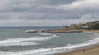
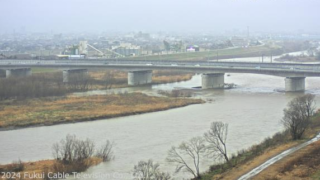
- Various locations within the prefecture | Mikuni/Sunset Beach, Fukui Station East/Daimyocho intersection, Kuzuryu River/Route 8 Fukui Ohashi Bridge, Asuwa River/Kidabashi, Ikeda Town/Scakage River/Cultural Exchange Center | Fukui Cable Television Co., Ltd.
- Rivers in the prefecture | Takeda River, Sokogami River, Arakawa, Kitsune River, Ebata River, Asami River, Hino River, Shono River, Minami River | Fukui Prefecture river and erosion control comprehensive information
- Rivers and national highways in the prefecture | State of rivers and roads in Fukui (Hino River, Fukaya, Fukui City, Kuzuryu River, Nakakaku, Fukui City, Kuzuryu River, Naruka Oi Fishway, Kitagawa, near Takatsuka, Obama City) | Fukui River and National Highway Office
- Rivers in the prefecture | Kuzuryu River, Hino River, Kitagawa River | Ministry of Land, Infrastructure, Transport and Tourism Kinki Regional Development Bureau Fukui River and National Highway Office
- Prefectural Roads | “Michi Information Net Fukui” “Road Information Net Fukui” | Fukui Prefecture Civil Engineering Department Road Maintenance Division
Prefectural National Highways / Ashihara City, Tsuruga City, Obama City, Takahama Town, Kono Road Station / Fukui River and National Highway Office - Hokuriku/Shinetsu Area Expressway | Banetsu Expressway, Hokuriku Expressway, Joshinetsu Expressway, Kanetsu Expressway, Tokai-Hokuriku Expressway, etc. | iHighway
Fukui Prefecture Tourism Information
The Fukui prefectural capital is Fukui City. The population of the prefecture is 800,000. The prefectural flower is narcissus and 3/4 of the prefectural land is forest. In Fukui City there is Ichijodani ruins that Sengoku Daimyo Asakura Yoshikage was based in. “Echizengani (Echizen crab)” and “Koshihikari (variety of rice)” are renowned as specialty products. Koshihikari is now in production all over the country, but it is a breed originally developed by Fukui Prefecture in 1956. Fukui rice is popular as the birthplace of Koshihikari. “Echizen coast”, “Mikatagoko (Mikata five lakes)”, “Tojinbo”, “Eiheiji (temple)”, “Obamanokosatsu (ancient temples in Obama)”, “Awara Onsen” and “Dinosaur Museum” are famous as tourist attractions.
In addition, there are about 55 nuclear power plants throughout the country and 15 of them are located in Fukui Prefecture, and it has become national one agglomerations of nuclear power plants. In Katsuyama City, dinosaur fossils were excavated and Japan’s largest Dinosaur Museum was built. Dinosaur bones and other numerous specimens, dioramas, visual materials are on display in the museum, and it is one of tourism attractions in Fukui Prefecture where more than 500,000 people visit annually.
Tojinbo in Sakai City is a cliff that is designated as a national natural monument. Overlooking the sea from the cliff as many as 25m of height is a masterpiece and you can also look up it from the sea using a pleasure boat. The origin of the name “Tojinbo” is derived from the monk “Tojinbo” who overlaid the evil and was pushed down from the cliff by Magaragakunen because of the tangle of romantic relationship.
Awara Onsen in the city of Awara is a hot spring that continued from 1883. There are accommodations of 15 hotels in the spa town that is visited by one million people a year.
Moreover, it is said that Fukui cannot be told without mentioning Echizen crab and Echizen crab that is caught off the coast Echizen is loved as the king of taste of winter. If you stay at hotels in Fukui, you can almost always see it. Tourists choose Fukui to visit to eat it. Echizen crab grows up in a tough environment and in the terrain that is suitable for the habitat of the crab off the coast of Echizen. It is sweet and delicious.
The local cuisines are “Echizen Oroshi Soba“, which is the boiled buckwheat noodles that are eaten with the soup stock and grated radish, and “Saba no Heshiko“, which is the preserved food in winter that are pickles of salted mackerel.