This page provides a collection of links to live camera pages for each city, town, and village in Kagoshima Prefecture. Kagoshima Prefecture stretches from north to south, encompassing the Satsuma and Osumi Peninsulas, Tanegashima and Yakushima Islands, and the Amami Islands. It is a region with many locations worth checking, such as Sakurajima, Mount Kirishima, the Kawanishi River, Kinko Bay, Shibushi Bay, and various ports and airports throughout the prefecture. For those searching for “Kagoshima Prefecture Live Cameras” or a “List of Kagoshima Prefecture Live Cameras,” we provide links to municipal pages organized by region to make it easy to check road conditions, river water levels, weather at volcanoes, coastlines, and tourist spots, as well as real-time updates during typhoons or heavy rain.
Live Cameras in the Kagoshima Area
These are areas with high demand for property inspections, centered around Kagoshima City and including Sakurajima, Kinko Bay, the Tenmonkan area, National Routes 10 and 224, and the Kotsu River.
Kagoshima City | Hioki City | Ichiki-Kushikino City | Mishima Village | Tojima Village
Live Cameras in the Minami-Satsuma Region
This area is convenient for checking the weather along the southern coast of the Satsuma Peninsula, at its ports, around Ibusuki and Mount Kaimon, along National Highways 225 and 226, and at tourist attractions.
Makurazaki City | Ibusuki City | Minami-Satsuma City | Minamikyushu City
Live Cameras in the Northern Satsuma Region
This area is ideal for checking conditions along the coast around Izumi, Akune, and Satsumasendai, as well as along the Sendai River, National Route 3, ports, and natural landscapes.
Akune City | Izumi City | Satsumasendai City | Satsuma Town | Nagashima Town
Live Cameras in the Aira and Isa Areas
This area makes it easy to check the weather and road conditions for Mount Kirishima, Kagoshima Airport, National Route 10, the Kawauchi River basin, and the mountainous regions.
Kirishima City | Isa City | Aira City | Yusui Town
Live Cameras in the Osumi Area
This area covers Kanoya, Tarumizu, Shibushi, and the Cape Sata region, and is useful for surveying Kinko Bay, Shibushi Bay, National Route 220, the East Kyushu Expressway, and rivers.
Kanoya City | Tarumi City | Soo City | Shibushi City | Osaki Town | Higashikushira Town | Nishikigawa Town | Minami-Osumi Town | Kimotsuki Town
Live Cameras in the Kumage Area
This is a convenient way to check the weather along the coast, at ports, in the mountains, at the Tanegashima Space Center, and on Yakushima Island—all part of the island group that includes Tanegashima and Yakushima.
Nishinoomote City | Nakaseed Town | Minamitanegashima Town | Yakushima Town
Live Cameras in the Oshima Area
This guide covers the Amami Oshima, Tokunoshima, Okinoerabu Island, and Yoron Island archipelago and is useful for checking the status of ports, airports, coastlines, and conditions during typhoons.
Amami City | Yamato Village | Setouchi Town | Tatsugo Town | Kikai Town | Tokunoshima Town | Amagi Town | Isen Town | Wadomari Town | Chimei Town | Yoron Town
Live Cameras of Rivers in the Prefecture
Rivers in Kagoshima Prefecture
Major Live Cameras Across the Prefecture
- Amami Airport (Kasari-cho, Amami City) ② | / Amami Airport Live Camera | Minami Nippon Broadcasting / KYT Kagoshima Yomiuri Television
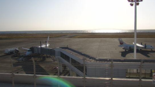
- Kagoshima Airport (Mizobe-cho, Kirishima City) ② ③ | / Kagoshima Airport Live Camera | Kagoshima Airport Building · Minami Nippon Broadcasting
- Sakurajima Live Camera | / Sakurajima Live Camera
- Shinmoedake Live Camera | / Kirishima Mountain Shinmoedake Live Camera | Japan Meteorological Agency / Kagoshima Yomiuri TV
- Mt. Tachū, Yakushima (Yakushima Town) | / Yakushima Mt. Tachū Live Camera | Internet Nature Research Institute
- Mt. Nagata, Yakushima (Nagata, Yakushima Town) | / Yakushima Mt. Nagata Live Camera | shingenn
- Kuchinoerabu Island (Yakushima Town) ② ③ ④ ⑤ ⑥ | / Kuchinoerabu Island Live Camera | Minami Nippon Broadcasting, Japan Meteorological Agency, Kagoshima Yomiuri Television (KYT)
- Kagoshima Chuo Station (Yojiro, Kagoshima City) | / KKB Live Camera Near Kagoshima Chuo Station | KKB Kagoshima Broadcasting
- Kohirasehana Lighthouse Live Camera (Wakimoto, Akune City, Kagoshima Prefecture) | / Kodairasehana Lighthouse Live Camera | Japan Coast Guard
- Satamisaki Lighthouse Live Camera (Sata Magome, Minamiosumi-cho, Kimotsuki-gun, Kagoshima Prefecture) | / Cape Sata Lighthouse Live Camera | Japan Coast Guard
- Tanegashima Lighthouse (Kugenaga, Minamitanegashima Town) ② | / Tanegashima Lighthouse Live Camera | Japan Coast Guard
- JAXA Tanegashima Space Center Live Camera | / JAXA Tanegashima Space Center Live Camera | JAXA Tanegashima Space Center
- Yamakawa Port (Yamakawa-Kinsei-cho, Ibusuki City) | / Yamakawa–Nezumi Ferry Route: Nankyu Yamakawa Port Live Camera | Ferry Nankyu Yamakawa Branch Office
- Nase Port (Nase Minato-cho, Amami City) | / Live Camera at Naze Port, Amami City | Minami Nippon Broadcasting
- Yamagawa-Nejime Ferry Route Nankyu Nejime Port Live Camera | / Nezumi Port Live Camera | Ferry Nankyu Nezumi Branch Office
- Akeshi Island (Akeshi Island, Toshima Village) | / Akushi Island Yasura Beach Port Live Camera | Tojima Village Office
- Suwanose Island (Suwanose Island, Toshima Village) | / Suwa-no-sejima Campground Live Camera | Japan Meteorological Agency
- Kikai Island (Kikai Town Bay) ② | / Kikai Island Live Camera | Kikai Town Hall and Minami Nippon Broadcasting (MBC)
- Iojima Iojima Port Live Camera | / Iwo Jima Iwo Jima Port Live Camera | Mishima Village Office
- Takeshima Port (Takeshima, Mishima Village) | / Takeshima Takeshima Port Live Camera | Mishima Village Office
- Kuroshima Osato Port Live Camera | / Kuroshima Osato Port Live Camera | Mishima Village Office
- Kuroshima Katadomari Port Live Camera | / Kuroshima Katadomari Port Live Camera | Mishima Village Office
- Shibushi Bay and Shibushi Port (Shibushi-cho, Shibushi City) | / Shibushi Bay and Shibushi Port Live Camera | Minami Nippon Broadcasting (MBC)
- East China Sea and Nishikata Coast Live Camera | / West Coast Live Camera | Satsumasendai City Hall and Minami Nippon Broadcasting (MBC)
- Kanehama Beach Live Camera | / Tetsuhama Beach Live Camera | Nishinoomote City Hall
- Fukiagehama and Eguchihama (Higashiichiki-cho, Hioki City) | / Fukiagehama and Eguchihama Live Cameras | Hioki City Hall · Minami Nippon Broadcasting
- Izumi Plain Crane Live Cameras | / Live Camera of Cranes in the Izumi Plain | Internet Nature Research Institute · Izumi City Crane Museum Crane Park Izumi
- National Routes 220 and 224 / Kagoshima City, Shibushi City, Kanoya City, Tarumizu City / Okuma River and National Highway Office
- Volcanoes in the Prefecture / “Volcano Camera Images”: Kuchinoerabu Island (Motomura Nishi, Yakushima Nagata); Suwanose Island (Yorigi, Campground) / Japan Meteorological Agency
- Kawauchi River / Kawauchi River Real-Time Disaster Prevention Information / Ministry of Land, Infrastructure, Transport and Tourism, Kyushu Regional Development Bureau, Kawauchi River Office
- Rivers in the Prefecture / Higashikushira Town, Kanoya City; Oji Bridge, Kanoya City; Otecho; Asahi Bridge, Mukai-cho; Shin-ei-cho Railroad Bridge; Shimona-Kimitsuki-cho, Gohei-cho; Kimotsuki River; Shimotani River; Takayama River; Aira River; Kushira River / Okuma River and National Highway Office
- National Highways in the Prefecture / National Route 3 (Kanayama Pass), Route 10 (Kamewari Pass, Ryugamizu), Route 225 (Mineo, Kawabe Pass), Route 226 (Maenohama) / Kagoshima National Highway Office
- Roads within the prefecture / National Route 220 (Ushine-Sakai District, Ukitsu District), Higashi-Kyushu Expressway (from Sueyoshi-Zaibe Interchange to Kanoya-Kushira Junction) / Okuma River National Highway Office
- Various locations throughout the prefecture / Sakurajima, Kamoike Port, Kinko Bay, Sakurajima Port, Gando Farm, Kasasa, Mount Kaimon, Izuro Street, Sekiyoshi Irrigation Canal, Chirinkajima, Kagoshima Airport / “Sakurajima Today” Kagoshima Live Camera Network (NPO)
- Various locations throughout the prefecture / Live Cameras in Kagoshima Prefecture: “Furupuri Live” / MBC Minami Nippon Broadcasting
- Various locations throughout the prefecture / Panoramic view of Sakurajima; Sakurajima’s Showa Crater (from the foot of Ushine, Tarumizu City); Sakurajima (from the KTS headquarters in Kagoshima City); Kagoshima cityscape (from the Yunohira Observation Deck); Mount Kaimon (from the Nagasaki-hana Parking Garden); Kuchinoerabu Island (from Nagata, Yakushima) / KTS Kagoshima Television
Kagoshima Prefecture Live Camera Map (Google Maps)
Weather Forecast for Kagoshima Prefecture
- Yahoo! Weather & Disasters – Weather in Kagoshima Prefecture
- Japan Meteorological Agency Disaster Prevention Information – AMeDAS (Temperature, Precipitation, Wind Direction and Speed, Sunshine Duration, Humidity, Atmospheric Pressure)
- Japan Meteorological Agency Disaster Prevention Information – Radar and Nowcast (Precipitation, Lightning, Tornadoes)
News from Kagoshima Prefecture
About Kagoshima Prefecture
Kagoshima Prefecture is located in southern Kyushu, and its prefectural capital is Kagoshima City. In addition to the Satsuma and Osumi peninsulas, it includes many remote islands such as Tanegashima, Yakushima, and the Amami Islands. The prefecture covers an area of approximately 9,188 square kilometers and has a population of about 1.5 million. With a wide range of attractions—including Sakurajima, Mount Kirishima, Mount Kaimon, the Kawanishi River, Kinko Bay, Shibushi Bay, Cape Sata, and the natural landscapes of Yakushima and the Amami Islands—live cameras are useful for checking road conditions, river water levels, volcanic activity, and weather conditions along coastlines, in ports, and at tourist destinations.