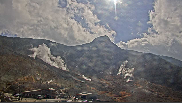
This is a live camera installed at Kurotamagokan in Owakudani, Sengokuhara, Hakone-machi, Ashigarashimo-gun, Kanagawa Prefecture. You can see images of Hakone/Owakudani, Mt. Hakone, and Owakudani parking lot. Distributed by Internet Nature Research Institute. You can also check the weather forecast, rain cloud radar and map.
Owakudani, at an altitude of 1,044m, was created by a volcanic landslide from Hakone Volcano, and is located on the northern slope of Mt. Kanmurigatake, at an altitude of 800m to 1000m. Currently, volcanic smoke activity continues and hydrogen sulfide is being generated. Black eggs made in Owakudani’s hot spring pond are a specialty of Owakudani, and are sold at Owakudani Kurotamagokan.
Live camera ② is a surveillance camera image of Mt. Hakone and Owakudani by the Japan Meteorological Agency.
watch live camera
Live camera information
- Distribution type – Still image
- Distribution/Management – Internet Nature Research Institute / Japan Meteorological Agency
- Related site – Owakudani Kurotamagokan
- Installation location – Owakudani, Sengokuhara, Hakone-machi, Ashigarashimo-gun, Kanagawa 250-0631
Weather in Hakone, Kanagawa
Rain cloud radar in Hakone, Kanagawa

Map of Sengokuhara, Hakone, Ashigarashimo District, Kanagawa (Google Maps)
- View Google Maps