Kyoto Prefecture Live Cameras
Kyoto Prefecture Southern (Kyoto)
Kyoto City | Uji City | Kameoka City | Joyo City | Muko City | Nagaokakyo City | Yawata City | Kyotanabe City | Nantan City | Kizugawa City | Oyamazaki Town | Kumiyama Town | Ide Town | Ujitawara Town | Kasagi Town | Wazuka Town | Seika Town | Minamiyamashiro Village | Kyotamba Town
Kyoto Prefecture Northern part (Maizuru)
Fukuchiyama City | Maizuru City | Ayabe City | Miyazu City | Kyotango City | Ine Town | Yosano Town
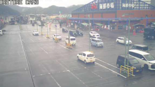
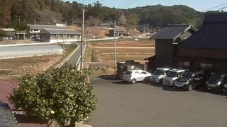
Entire area of Kyoto Prefecture
- Katsura River | Kinki Regional Development Bureau, Ministry of Land, Infrastructure, Transport and Tourism
- Entire Kyoto Prefecture | Kyoto Prefectural Road Information System | Kyoto Prefectural Government Construction and Transportation Department Road Management Division
- Yura River | Yura River real-time disaster prevention information | Fukuchiyama River and National Highway Office, Kinki Regional Development Bureau, Ministry of Land, Infrastructure, Transport and Tourism
- Yodo River, Katsura River, Uji River, Kizu River | Disaster prevention information live camera | Ministry of Land, Infrastructure, Transport and Tourism Kinki Regional Development Bureau Yodogawa River Office
- Rivers in Kyoto Prefecture | River disaster prevention camera installation map (whole prefecture) | Kyoto Prefecture river disaster prevention information
- Kyoto Jukan Expressway | “Kyoto Jukan Expressway Live Camera” Amanohashidate area, Miyazu Amanohashidate IC, Maizuru Oe IC, Yuragawa PA, Ayabe JCT, Ayabe Ankokuji IC, Kyotanba Wachi IC | Kyoto Prefectural Road Public Corporation
- National Route 1 and Route 9 | “Kyoto Road Live Camera” | Ministry of Land, Infrastructure, Transport and Tourism Kinki Regional Development Bureau Kyoto National Highway Office
Kyoto Prefecture Tourism Information
As for Kyoto Prefecture in Kinki Region, the north faces the Sea of Japan and Fukui Prefecture, the east Mie Prefecture and Shiga Prefecture, the south Osaka and Nara Prefecture, the west Hyogo Prefecture. The prefecture soil area is 4,613 square km of 1.2% of the country and about 3/4 of the government area is mountains. The prefecture land extends to about 140km from the northwest of the Sea of Japan side to the inland of the southeast, in boundary Tabayama in the central part of the prefecture the north is the climate of the Sea of Japan side and the south is inland climate.
The prefectural population is about 2.62 million people, the population of Kyoto City, the prefectural capital, is approximately 1.4 million people, more than half of the prefectural population. The prefectural land, which faces the Sea of Japan, the Maizuru Bay and the Wakasa Bay, is divided into “north” in which there are Tango Peninsula, Tango Mountains and Fukuchiyama Basin, “center” in which there are Tanba Plateau and Kameoka Basin, and “southern” in which there is Kyoto Basin.
Tango region is composed of Kyotango, Ine, Yosano, Miyazu and Maizuru, and there are attractions such as “Amanohashidate” of Japan Sankei, one of the three great views of Japan, Ine Urafune-ya group, Chirimen Kaido(Crepe Road) and Maizuru red brick warehouses.
Tamba region is composed of Fukuchiyama, Ayabe, Kyotangocho, Nantan-cho and Kameoka, and there are tourism attractions such as Fukuchiyama Castle of Akechi Mitsuhide, Miyama Kayabuki no Sato (the village of thatched houses), Hozu River Rafting, Truck Trains and Yunohana Onsen.
Yamashiro region in the southern part of the prefecture consists of 7 Cities, 7 towns and one village, such as Nagaokakyo City and Uji City, and there are tourism attractions, such as Nagaokakyo trace, which is called phantom of capital, Byodoin, Ujigami Shrine and tea plantations of Uji tea.
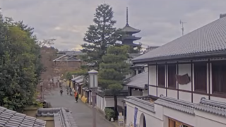
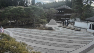
In Kyoto City, the center of Kyoto Prefecture there is the Imperial Palace of Emperor of Japan, which became the residence of successive emperors, and there are many attractions that you can feel the history of one thousand years of the ancient capital Kyoto, such as Kinkakuji and Ginkakuji, the world cultural heritages, Kiyomizu Temple, Nijo Castle, Sanjusangendo, Kodai-ji Temple and Fushimi Inari shrine.
The local cuisines include “Kyoto pickles”, immerse Lightly Salted Kyoto traditional vegetables, and “Dengaku of Kamo eggplant”, the miso Dengaku of Kyoto traditional vegetables “Kamo eggplant”.