Tokushima Prefecture Live Cameras
Tokushima Prefecture Northern part (Tokushima)
Tokushima City | Naruto City | Komatsushima City | Yoshinogawa City | Awa City | Mima City | Miyoshi City | Sanagochi Village | Ishii Town | Kamiyama Town | Matsushige Town | Kitajima Town | Aizumi Town | Itano Town | Kamiita Town | Tsurugi Town | Higashimiyoshi Town
Tokushima Prefecture Southern part (Hiwasa)
Anan City | Katsuura Town | Kamikatsu Town | Naka Town | Mugi Town | Minami Town | Kaiyo Town
All over the prefecture
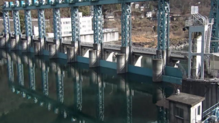
- Katsuura River / Tsukigatani Onsen, Masaki Dam, Hoshitani Bridge / Katsuura Town / Kamikatsu Town Live Camera
- Yoshinogawa / Yoshinogawa Bridge, Tenth Weir, Awa Chuo Bridge, Iwatsu Bridge, Miyoshi Ohashi, Odera / Tokushima River National Highway Office
- Minami Town / Mugi Town / Kaiyo Town / Disaster Prevention Cameras in Each Town / Kaifu District Intranet
- Nakagawa / Kuwanogawa / Furusho point of Nakagawa, Ohara point of Kuwanogawa only during floods / Nakagawa river office
- Prefectural Road / “Shikoku Road Camera Image” National Route 32 (near Yamaguchi Town, Miyoshi City), National Route 55 (near Fukui Town, Anan City), National Route 192 (near Miyoshi City Border Pass), National Route 192 (Higashimiyoshi Town) Near Yamaguchidani Bridge) / Shikoku Regional Development Bureau, Ministry of Land, Infrastructure, Transport and Tourism
- Nakagawa River and Kuwanogawa River, camera titles: Nakagawa River Furusho Point, Kuwanogawa River Ohara Point, Live video is deliveried only during flood, site title: Nakagawa River Office
- Roads in Tokushima Prefecture, camera title: Shikoku Road Live Images, National Route 11, 32, 33, 55, 56 and 192, site title: Ministry of Land, Infrastructure, Transport and Tourism Shikoku Regional Development Bureau
- Uchiduma Coast, address: ONO GLASS WORKS, 450 Kouchi, Mugyo-cho, Kaifu-gun, Tokushima, site title: ONO GLASS WORKS
- Yoshinogawa River, camera titles: “Yoshino River Live Video,” ①Yoshino River Bridge, ②Near the Tenth Weir, ③Near Awa Central Bridge, ④Near Iwadu Bridge, ⑤Near Miyoshi Ohashi Bridge, ⑥Near Odera, site title: Tokushima Office of River and National Highway, Shikoku Regional Development Bureau, Ministry of Land. Inflastructure and Transport
Tokushima Prefecture Tourism Information
The prefectural capital of Tokushima is Tokushima City. The population of the prefecture is 786,000 people. Tokushima was once called “Awa country” because chestnut was taken in the area, which was once ruled by Sengoku Daimyo Mr. Miyoshi. There are famous tourism resources such as “Awa Odori,” “Naruto no Uzushio (Whirlpools of Naruto),” “Iyakei (Iya Valley),” “Oboke-Koboke,” “Tsurugi-san (Mt. Tsurugi),” and “Yoshino River.”
“Naruto no Uzushio (Whirlpools),” a strait that is located between Magosaki in the city of Naruto and Awaji Island, are seen at low tide and high tide. “Uzu no Michi (Road of Vortex)” is the prefectural facility that was installed in the girders of the Onaruto Bridge, and the air promenade that extends to 450m makes you feel as if you were standing on the sea and looking down into the whirlpools.
Moreover, there is also a powerful look at a stone’s throw away in the whirlpools cruise ship, feeling the sense of smell of the tide. “Yoshino River” is the largest river in Shikoku, which is 192km totl length and accounts for 20% of the Shikoku area. There is “Oboke-Koboke”, the valley that was born through 200 million years, in the basin, and it is famous for rafting and Oboke sightseeing boat down the valley. “Tsurugi-san (Mt. Tsurugi)” is the second highest mountain in West Japan, which is a religious sacred mountain of 1955m altitude, and it is higher mountain to Mount Ishizuchii. The mountain is relatively easy to climb thanks to a mountain lift.
“Awa Odori” is one of the nation’s largest festivals, which more than one million tourists visit every year, and is the lantern festival dance that can be called typical presence of Tokushima tourism. The slogan of the dance, “The fool dancing, the fool seeing, if both are fool, it’s a loss not to dance.” is famous, and the dance “Awa Odori” is listed in the three major Japanese lantern festivals along with “Nishimonai no Bon Odori” in Ugo town in Akita Prefecture and “Gujo Odori”. “Awa Odori” is the largest festival of the prefecture of Tokushima and tourists flock to see it from all over the country. In Tokushima Awa Odori Kaikan, you can watch Awa Odori even if it is not a festival season.
There are some local cuisines such as “Soba-gome Zousui (buckwheat rice porridge),” the fruit of buckwheat boiled with vegetablesand meat, and “Bouze no Sugata Zushi,” which is made from “Bouze (butterfish)” and “Japanese citrus.”