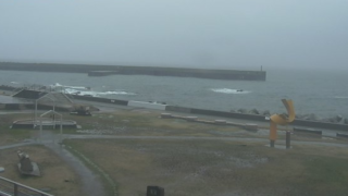
Niigata Prefecture Live Cameras
Niigata Prefecture Kaetsu (Niigata)
Niigata City | Shibata City | Murakami City | Tsubame City | Gosen City | Agano City | Tainai City | Seiro Town | Yahiko Village | Aga Town | Sekikawa Village | Awashimaura Village
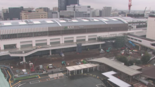
Niigata Prefecture Chuetsu (Nagaoka)
Nagaoka City | Sanjo City | Kashiwazaki City | Ojiya City | Kamo City | Tokamachi City | Mitsuke City | Uonuma City | Minami Uonuma City | Tagami Town | Izumozaki Town | Yuzawa Town | Tsunan Town | Kariwa Village
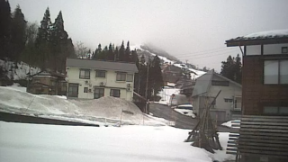
Niigata Prefecture Joetsu (Takada)
Itoigawa City | Myoko City | Joetsu City
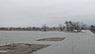
Niigata Prefecture Sado (Aikawa)
All over the prefecture
- Shinano River / Shinano River Basin (Nagaoka City, Tsubame City, Ojiya City) / Shinano River Office
- Shinano River / “Shinano River Downstream Live Camera” / Shinano River Downstream River Office
- Shinano River / “Shinano River Live Camera” / Shinano River Office
- Arakawa / Arakawa observation points / Haneko River National Highway Office
- Yakeyama / Niigata Prefecture Yakeyama Volcano Monitoring System / Japan Meteorological Agency Niigata Yakeyama
- Prefectural rivers / feather side, Aikawa river, Imo river, Aburuma river, Uono river, Nakatsu river, Kama river / Yuzawa sabo office
- Prefecture / Niigata prefecture live camera “Niigata LIVE camera” National Highway No. 7, and No. 17 National Highway, No. 116 national highway, 253 national highway, National Highway 353 Issue / Niigata Furusato Information Bureau
- Prefectural Roads / “Niigata LIVE Camera (Chuetsu Regional Road Cameras” National Routes 8, 17, 116, 117, 252 / Niigata Prefecture IT & ITS Promotion Council
- Mikuni River / Left bank top (dam lake), Reservoir (dam discharge status), Ogawa Bridge (near Ogawa Bridge), Mikuni River Bridge (near Sakuri Water Park), Cross Gorge (upstream of dam lake) / Sagurigawa Dam Management Place
- Rivers in Niigata Prefecture, camera title: Yuzawa erosion control office disaster prevention information, site title: Yuzawa erosion control office
- Roads in Niigata Prefecture, camera titles: National Route 8, 17, 116, 117, 252, 253, 353, site title: Niigata Live Camera
- Throughout the prefecture, camera title: Niigata LIVE Camera, site title: Niigata, Furusato Information Bureau
- Shinano River, camera title: Shinano River Live Camera, site title: Shinanogawa River Office
- Shinano River, camera titles: Shinano River Downstream Live Camera, address: Shinano River Downstream River Office, 16-9 Bunkyo-cho, Chuo-ku, Niigata-shi, Niigata-ken 951-8153, site title: Ministry of Land, Infrastructure and Transport Hokuriku Regional Development Bureau Shinano River downstream river office
- Arakawa River, camera title: Real-time information of Arakawa River, address: Hokuriku Regional Development Bureau Uetsu River National Highway Office, Ministry of Land, Infrastructure and Transport, 27-1 Fujisawa, Murakami-shi, Niigata-ken 959-3131, site title: Uetsu River National Highway Office
- Sekikawa River, camera title: Sekikawa-Himekawa CCTV viewing page, site title: Ministry of Land, Infrastructure and Transport Hokuriku Regional Development Bureau Takada River National Highway Office
- Mt. Yakeyama, camera titile: Yakeyama Onsen Information, Hiuchi No. 1 dam information, site title: Niigata yakeyama volcano monitoring system
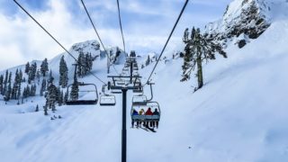
Niigata Prefecture Tourism Information
Niigata Prefecture, which is located in the Sea of Japan side, is in contact with Yamagata Prefecture, Fukushima Prefecture, Gunma Prefecture, Nagano Prefecture and Toyama Prefecture. The prefectural population is about 2.37 million people, Niigata City, the prefectural capital, is a government-designated city of about 810,000 people. The whole areas of the prefecture are specified in heavy snowfall, and some of them are specified in the special heavy snowfall.
The prefecture consists of 20 cities, 9 provinces, 6 towns and 4 villages. In Niigata prefecture there are mountainous regions such as Komagatake in Uonuma City, Nakanodake of Uonuma-Minamiuonuma, Hakkaisan of Minamiuonuma City, which are called Echigo three mountains, and the 11 mountains of the prefecture are specified in Japan hyakumeizan, 100 famous mountains in Japan.
In addition, the number of shrine in Niigata Prefecture is national one and there are about 4,780 shrines in the prefecture. The second place is Hyogo Prefecture in which tehre are about 3,800 shrines, and 3 place is Fukuoka Prefecture in which there are about 3,400 shrines.
The size of the area of Niigata Prefecture is 12,583 square kilometers and fifth place in the whole country, and its population was 1.66 million people and first place in the whole country in the census of 1888, which surpassed the population of Tokyo Metropolitan Government, 1.35 million people.
It is also said that many shrines were erected because it was the vast prefectural land and Japan’s leading rice plants where a lot of population could be fed. The prefectural land is divided into four regions, Joetsu region, Chuetsu region, Kaetsu region and Sado region. Although the domain system was abolished in 1871 and 13 counties was established in the current Niigata area, the 13 counties became the three prefectures, Niigata Prefecture, Kashiwazaki Prefecture and Aikawa Prefecture due to the subsequent prefectures integration, and later Niigata Prefecture was born in the form that it merged the other two prefectures.
The local cuisines are “Noppei-jiru,” the soup in which plenty of seasonal vegetables such as taro, burdock, lotus root and carrots are used and chicken and salmon are added, “Sasa Sushi,” the sushi rice on top of the bamboo leaves topped with ingredients and spices.