YAMANASHI PREFECTURE LIVE CAMERAS
Yamanashi Prefecture Midwest (Kofu)
KOFU CITY | YAMANASHI CITY | NIRASAKI CITY | MINAMI ALPS CITY | HOKUTO CITY | KAI CITY | FUEFUKI CITY | KOSHU CITY | CHUO CITY | ICHIKAWAMISATO TOWN | HAYAKAWA TOWN | MINOBU TOWN | NANBU TOWN | FUJIKAWA TOWN | SHOWA TOWN
Yamanashi Prefecture Eastern Fuji Five Lakes (Lake Kawaguchi)
FUJIYOSHIDA CITY | TSURU CITY | OTSUKI CITY | UENOHARA CITY | DOSHI VILLAGE | NISHIKATSURA TOWN | OSHINO VILLAGE | YAMANAKAKO VILLAGE | NARUSAWA VILLAGE | FUJIKAWAGUCHIKO TOWN | KOSUGE VILLAGE | TABAYAMA VILLAGE
All over the prefecture
- Major national roads in the prefecture | “Michi Camera (rainfall / video)”: National Routes 20, 52, 138, 139 | Kofu River and National Highway Office
- Major rivers in the prefecture | “Kawa camera (image / water level)” : Kamanashi River, Shio River, Midai River, Fuefuki River, Shigekawa, Hikawa, Fuji River, Hayakawa | Kofu River and National Highway Office
Yamanashi Prefecture Tourism Information
Yamanashi Prefecture was renamed from Kofu Prefecture to Yamanashi Prefecture by abolition of feudal domains and establishment of prefectures in 1871. The prefectural name is derived from Yamanashi County where the prefectural capital exists. Under the Edo shogunate Kofu clan of Kuninaka Region centering around the Kofu Basin of the Midwest and Tanimura clan of Gunnai Region of the east had ruled.
The prefectural land is divided into Yamanashi County, Yashiro County, Kuninaka region of Koma-gun and Gunnai region of Tsuru-gun. Although Takeda Shingen was proud of the forces in the Warring States period, Takeda family was destructed by the Koshu conquest in 1582 in the reign of Takeda Katsuyori. Then, Kai country, the previous name of Yamanashi Prefecture, was ruled by Tokugawa Ieyasu and Toyotomi Hideyoshi, and in the era of the Tokugawa shogunate it was ultimately governed as a Shogunate Territory. Yamanashi Prefecture put an emphsis on Takeda Shingen who boasted the mighty forces in the Warring States period, and it plays an important role in the tourism industry.
There are many tourism attractions related to Takeda Shingen in the prefecture, such as Takeda Shrine, the family temple of Takeda Shingen “Keitokuzan Erinji”, Shimobe Onsen, Kai Zenko-ji temple, and there are many souvenirs and special products related to Shingen, such as Shingenmochi (Shingen rice cakes) and Shingenmomo (Shingen peach).
Yamanashi Prefecture, which is divided into Kanto region or Koshinetsu region, is a landlocked province that is surrounded by Shizuoka Prefecture, Kanagawa Prefecture, Tokyo, Saitama Prefecture and Nagano Prefecture. The north is Yatsugatake foothills, the east Okuchichibu Mountains, the west Akashi Mountains of Southern Alps, and the south is surrounded by Mount Fuji, and about 80% of the prefectural land total area of 4,465 square km is mountainous. Because it is the inland province that is surrounded by mountains it is less affected by monsoon, and it is characterized by less precipitation, many sunny days and intense difference of heat and cold.
In Yamanashi Prefecture fruit cultivation is flourishing among agriculture from such climate characteristics, it is the “fruit kingdom” in which fruit growing, such as peach, grape, plum and cherries, accounts for nearly half of the agricultural production value.
The prefectural population is about 850,000 people, and the population of the prefectural capital, Kofu City, is about 200,000 people. Yamanashi has developed around the Kofu Basin, and in the Warring States period Takeda Shingen, who led the Takeda cavalry troops that was said to be the strongest cavalry corps, dominated.
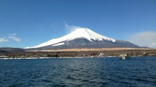
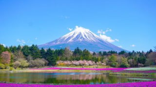
In Mt. Fuji and the Fuji Five Lakes region in Minamitsuru County of the southern Yamanashi, tourism such as climbing Mount Fuji, Mt. Fuji tour, sightseeing in Fuji Five Lakes, leisure, water sports flourishes, and not only tourist facilities but also eateries and accommodations are booming.
There are the village of thatched roof houses, “Iyashi no Sato Nemba”, Koyodai, Narusawa ice cave, Fugaku air hole, Oshino Hakkai (Oshino eight seas), Fuji-Q Highland and Yamanaka flower City park, in addition to the Fuji Five Lakes, Mt. Fuji, Lake Motosu, Lake Saiko, Lake Shoji, Lake Kawaguchi and Lake Yamanaka, as tourism attractions. The local cuisines include “Hoto”, wide noodles and vegetables that are stewed in the juice of miso, and “Yoshida Udon”, thick firm noodles in the soup of miso and soy sauce.