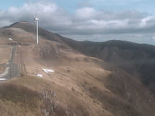
This is a live camera installed at Himetsurudaira campsite in Otado, Yusuhara-machi, Takaoka-gun, Kochi Prefecture. You can see the Shikoku Karst, Yusuhara Town Wind Power Plant, and Kochi Prefectural Road 383 Shikoku Karst Park longitudinal line. It is operated by Yusuhara Town Hall. You can also check the weather forecast and rain cloud radar.
Shikoku Karst is a karst plateau that straddles the prefectural border between Kochi Prefecture and Ehime Prefecture, at an altitude of 1000 to 1500 m, and extends approximately 25 km from east to west. It is one of Japan’s three major karsts, along with Akiyoshidai in Yamaguchi Prefecture and Hiraodai in Fukuoka Prefecture. Karst is a landform formed when limestone is eroded by rainwater.
watch live camera
Live camera information
- Delivery type – Still image
- Distribution/Management – Yusuhara Town Office
- Installation location – Otado, Yusuhara-cho, Takaoka-gun, Kochi Prefecture 785-0603
Weather in Yusuhara, Kochi
Rain cloud radar in Yusuhara, Kochi

雨雲レーダー - Yahoo!天気・災害
全国各地の実況雨雲の動きをリアルタイムでチェックできます。地図上で目的エリアまで簡単ズーム!
weather.yahoo.co.jp
Map of Otado, Yusuhara, Kochi (Google Maps)
- View Google Maps