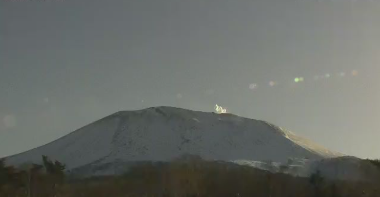
This is a live camera installed at Onioshi in Kamabara, Tsumagoi Village, Gunma Prefecture. You can see Mt. Asama. It is operated by the Japan Meteorological Agency.
Mount Asama is an active volcano with an altitude of 2,568 meters located on the border between Karuizawa and Miyota towns in Kitasaku District, Nagano Prefecture, and Tsumagoi Village in Azuma District, Gunma Prefecture. Although it is still an active volcano, Mt. Asama, with its natural beauty that changes throughout the seasons, has been designated as Joshinetsu Kogen National Park and one of Japan’s 100 Famous Mountains.
Live camera ② allows you to see the crater of Mt. Asama, and live camera ③ allows you to see the entire view of Mt. Asama.
watch live camera
- View live camera ① (Mt. Asama Onioshi)
- View live camera ② (Mt. Asama crater)
- View live camera ③ (Mt. Asama)
- View live camera ④
- View live camera ⑤
Live camera information
Live camera ①
- Delivery type – still image
- Distribution/Management – Japan Meteorological Agency
- Installation location – Kamabara, Tsumagoi Village, Agatsuma District, Gunma Prefecture
Live camera ②
- Distribution type – video
- Distribution/Management – Maechannet
- Installation location – Mt. Asama crater
Live camera ③
- Distribution type – video
- Distribution/Management – Maechannet
- Installation location – Mt. Asama
Live camera ④
- Distribution type – Still image
- Distribution/Management – Maechannet
- Installation location – Ozasa, Tsumagoi Village, Agatsuma District, Gunma Prefecture (approximately 8.8 km north of Mt. Asama)
Live camera ⑤
- Distribution type – Still image
- Distribution/Management – Tone River Water System Sabo Office
- Installation location – Tashiro, Tsumagoi Village, Gunma Prefecture (approx. 8 km northwest of Mt. Asama)
Weather in Tsumagoi Village, Gunma Prefecture
Rain cloud radar in Tsumagoi Village, Gunma Prefecture
雨雲レーダー - Yahoo!天気・災害
全国各地の実況雨雲の動きをリアルタイムでチェックできます。地図上で目的エリアまで簡単ズーム!
Map of Tsumagoi Village, Gunma Prefecture (Google Maps)
- View Google Maps
