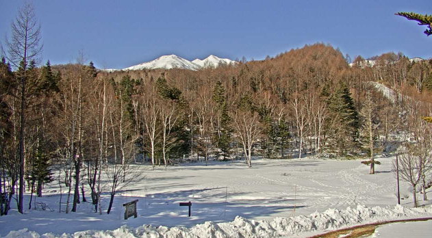
This is a live camera installed at Norikura Highland / Mt. Norikura (Matsumoto City, Nagano Prefecture). You can see Mt. Norikura from the Norikura Highlands. It is operated by the Internet Nature Research Institute and the Japan Meteorological Agency.
Norikura Plateau is a highland area located in the Azumi district of Matsumoto City, Nagano Prefecture, east of the southern Hida Mountains. Mt. Norikura is a general name for a mountain range consisting of 23 peaks, 7 lakes, and 8 plains, with Kengamine (altitude 3,026 m) as the highest peak. It has a rich natural environment and tourist resources such as Ichinose Garden, Skunk Basho Plantation, Zengoro Falls, Sanbon Falls, Bansho Otaki Falls, and Zengoro Falls, and is popular as a tourist and leisure destination for summer escape, mountain climbing, and skiing.
You can also check the weather forecast, rain cloud radar and map.
watch live camera
Live camera information
- Distribution type – Still image
- Distribution/Management – Internet Nature Institute / Japan Meteorological Agency
- Installation location – 4307 Azumino, Matsumoto City, Nagano Prefecture
Weather in Matsumoto City, Nagano Prefecture
Rain cloud radar in Matsumoto City, Nagano Prefecture

Weather forecast for central and southern Nagano Prefecture
Map of Azumi, Matsumoto City, Nagano Prefecture (Google Maps)
- View Google Maps