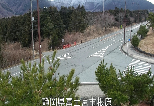
This is a live camera installed at various locations on National Route 139, which runs through Fujinomiya City, Shizuoka Prefecture. National Route 139 is a general national highway with a total length of 139 km, starting in Fuji City, Shizuoka Prefecture, passing through Fujinomiya City, Fujiyoshida City, Yamanashi Prefecture, and Otsuki City, and ending in Okutama Town, Nishitama District, Tokyo.
The live cameras are operated by the Shizuoka National Highway Office of the Chubu Regional Development Bureau of the Ministry of Land, Infrastructure, Transport and Tourism, and are installed at six locations: Shiraito Falls, Asagiri Plateau, and near the Yamanashi prefectural border. Through the live camera, you can check the local weather, congestion and road conditions on National Route 139, and snow conditions in the winter.
National Route 139 around Fujinomiya City is normally busy with traffic, but in the mornings and evenings it becomes extremely congested with many cars commuting to work and school. Furthermore, on Saturdays, Sundays, and holidays, vehicles from both inside and outside the prefecture pass through for sightseeing, such as sightseeing at Mt. Fuji, resulting in congestion and traffic jams.
The live camera shows the road of National Route 139, so it is not only useful for understanding the road surface and road conditions in the event of bad weather such as heavy rain or typhoons, but also allows you to check road conditions such as snow accumulation in the winter.
- watch live camera
- Live camera information
- Map and rain cloud radar of National Route 139 (Fujinomiya City, Shizuoka Prefecture)
- Weather in Fujinomiya City, Shizuoka Prefecture
- Shizuoka Prefecture weather forecast
- Google Map of National Route 139 (Fujinomiya City, Shizuoka Prefecture)
- Related videos of National Route 139 (Fujinomiya City)
watch live camera
Live camera information
- National Route 139 Shiraito Falls South Exit (Kamiide IC) 20.8KP (Inbound Lane: towards Fuji)
- National Route 139 Shiraito Falls North Exit (Uchino IC) 22.9KP (Inbound: toward Fuji)
- National Route 139 Asagiri Kogen 1 32.2KP (Inbound: towards Fuji)
- National Route 139 Asagiri Roadside Station 34.0KP (Outbound: towards Yamanashi)
- National Route 139 Asagiri Kogen 2 35.3KP (Inbound: towards Fuji)
- National Route 139 Yamanashi Prefecture border 36.5KP (Outbound: towards Yamanashi)
Map and rain cloud radar of National Route 139 (Fujinomiya City, Shizuoka Prefecture)
Weather in Fujinomiya City, Shizuoka Prefecture
Shizuoka Prefecture weather forecast
Google Map of National Route 139 (Fujinomiya City, Shizuoka Prefecture)
- View street view
