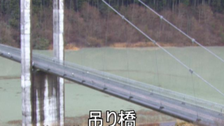
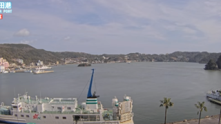
SHIZUOKA PREFECTURE LIVE CAMERAS
Central Shizuoka Prefecture (Shizuoka)
Shizuoka City | SHIMADA CITY | YAIZU CITY | FUJIEDA CITY | MAKINOHARA CITY | YOSHIDA TOWN | KAWANEHONCHO TOWN
Western Shizuoka Prefecture (Hamamatsu)
Hamamatsu City | IWATA CITY | KAKEGAWA CITY | FUKUROI CITY | KOSAI CITY | OMAEZAKI CITY | KIKUGAWA CITY | MORI TOWN
Eastern part of Shizuoka Prefecture (Mishima)
NUMAZU CITY | MISHIMA CITY | FUJINOMIYA CITY | FUJI CITY | GOTEMBA CITY | SUSONO CITY | SHIMIZU TOWN | NAGAIZUMI TOWN | OYAMA TOWN
Shizuoka Prefecture Izu (Ajiro)
ATAMI CITY | ITO CITY | SHIMODA CITY | IZU CITY | IZUNOKUNI CITY | HIGASHIIZU TOWN | KAWAZU TOWN | MINAMIIZU TOWN | MATSUZAKI TOWN | NISHIIZU TOWN | KANNAMI TOWN
All over the prefecture
- Tenryu River, Shin-Toyone Dam and Kikugawa River | Tenryu River, Shin-Toyone Dam, Kikugawa | Hamamatsu River and National Highway Office, Chubu Regional Development Bureau, Ministry of Land, Infrastructure, Transport and Tourism
- National Route 1 and Route 474 | Camera Title: “Roads Seen on Live Camera” National Highway No. 1 (Fujieda City, Shimada City, Kakegawa City, Fukuroi City, Iwata City, Hamamatsu City, Kosai City), No. 474 (Hamamatsu City, Shinshiro City) | National Land Hamamatsu River and National Highway Office, Chubu Regional Development Bureau, Ministry of Transportation
- Numazu River National Information Office Jurisdiction roads, rivers, coasts | “Real-time disaster prevention information” – Fuji Coast, Izu Jukan Expressway (Higashi Suruga Bay Circular Road), Kano River upstream/downstream, Kano River Sabo, National Route 138 (Subashiri), National Route 246 (Oyama) , National Route 1 (Hakone) | Ministry of Land, Infrastructure, Transport and Tourism Chubu Regional Development Bureau Numazu River National Highway Office
- Shizuoka National Highway Office Jurisdiction Roads | “Live camera and current road information board” – National Highway No. 1 Seishin Bypass, National Highway No. 1 Fuji Yui Bypass, National Highway No. 1 Fujieda Bypass, National Highway No. 52, National Highway No. 139 / Ministry of Land, Infrastructure, Transport and Tourism Chubu Regional Development Bureau Shizuoka National Highway office
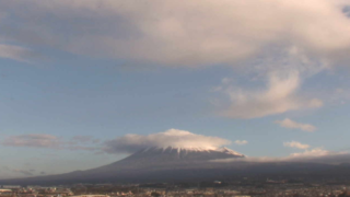
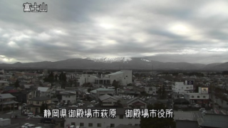
- Various places in the prefecture | Ito, Mt. Fuji Shizuoka Airport, Yui (Shimizu Ward, Shizuoka City), 4 live cameras in Shizuoka Prefecture | Shizuoka Asahi TV News
- National Routes 139, 469, Fuji Park Tarobo Line, Prefectural Route 414 | “Fuji Civil Engineering Live Camera” Nehara, Mizugatsuka, Fujinomiyaguchi 2nd Station, Children’s Country Entrance, Sekotsuji, Shinozaka | Fuji Civil Engineering Office Maintenance and Management Division
- National Routes 136, 138, 414, 469, Ito Shuzenji Line, Ito Ohito Line, Shuzenji Toda Line, Gotemba Oi Line, Atami Hakone Pass Line, Atami Kannami Line / “Shizuoka Prefecture Numazu Snow Live Camera” Funabara Tunnel, Hiekawa Tunnel, Kameishi Pass, Jurigi, Otome Pass, Toda Pass, Amagi Pass, Ashigara Pass, Atami Pass, Takanosuyama Tunnel, Fukasawa East/West Intersection, Lake Intersection | Numazu Civil Engineering Office Maintenance and Research Section
- Shizuoka Prefecture Comprehensive Civil Engineering Disaster Information | Locally-based disaster prevention site “Saipos Radar” operated by Shizuoka Prefecture
Shizuoka Prefecture Tourism Information
Shizuoka Prefecture lies in the Pacific Ocean side of the Tokai and Chubu region and its southern part faces the Suruga Bay, eastern part is contiguous with Kanagawa Prefecture, northern part is contiguous with Yamanashi Prefecture and Nagano Prefecture, and there is Mount Fuji. The prefectural land area is 7,780 square km, 155km from east to west and 118km from north to south.
In the northern part, there are contiguous 3,000m altitude class Akaishi Mountains in the Southern Alps, and there are the headwaters of Oi River and Abe River. There are Mount Fuji, Mt. Hakone, Izu Peninsula in the eastern part, there are plateaus and plains, such as Makinohara and Mikatahara in the western part. With the exception of the heavy snowfall areas of Akaishi Mountains in the northern part and Mt. Fuji, Shizuoka as a whole is warm humid Pacific Ocean side climate, but Gotemba is relatively a cold region because there is snow in the winter.
Mt. Fuji tourism flourishes in the eastern part of Mount Fuji peripheral zone, and there are “Fujisan Hongu Sengen Taisha Shrine” and “Shiraito Falls” in Fujinomiya city, which are the configuration assets of the world cultural heritage, “Mt. Fuji.”
There are Tomei Expressway and New Tomei Expressway as the gateway to Mount Fuji in Fuji City, and the city has accepted the tourists from all over the country to Fuji Mountain. Gotemba City is close to Tokyo metropolitan area, Hakone, the Fuji Five Lakes, and close to the Mount Fuji trail Subashiri Route at the time of climbing Mount Fuji, and it is a tourist route to Lake Yamanaka and the Lake Kawaguchi in Yamanashi Prefecture.
The local cuisines are “Fujinomiya yakisoba”, a Class B gourmet, which became the forerunner of local gourmet, “Sakuraebi-no-Kakiage”, mixed vegetables and Sakura shrimp tempura, “Unagi no Kabayaki (grilled eel)”, the grilled eel that is farmed in Lake Hamana.
Shizuoka Prefecture is divided by the Fujikawa River and the Oigawa River as boundaries into eastern region, central region and western region. The east of the Fujikawa is eastern region, the area between the Fujikawa and the Oigawa is central region, and the west of the Oigawa is western region. The prefecture consists of 23 cities, 5 counties and 12 towns. The prefectural land area is very long 155km from east to west, and it includes the regions of the former three countries, Izu Province, Suruga Province and Enshu Province.
Minamoto no Yoritomo, the Founder Shogun of Kamakura shognate, spent his childhood in Nirayama of Izu Province. His father was killed and he was caught, and he was exiled to Nirayama by Taira no Kiyomori. Yoritomo spent the misfortune of age, and the daughter of Hojo Tokimasa, Masako, became his wife, and he finally opened Kamakura shogunate, subduing powerful families such as Hojo family and other local families.
In response to the Arrival of Matthew PERRY squadron in 1853, Shimoda Port along with Hakodate Port opened in Izu Province in 1854. In the Age of Civil Wars Imagawa family emerged, Imagawa Yoshimoto ruled the three provinces, Suruga Province, Totomi Province and Mikawa Province, and became a major force in Japan. Then Imagawa forces weakened after Imagawa Yoshimoto was overthrown by Oda Nobunaga, Tokugawa Ieyasu gained power in Mikawa Province and Totomi Province.
After Shogunate was opened in Edo, Tokugawa Ieyasu perform politics at Sumpu Castle, and there are a number of lands that are related to large historical figures in Shizuoka. As Shizuoka Prefecture tourist destinations, there are “Miho no Matsubara”, one of the configuration assets of World’s cultural heritage, “Mt. Fuji”, “Sumpu Park”, the park where Sumpu Castle existed, “Kunozan Tosho-go”, the temple that enshrines Tokugawa Ieyasu, and “Hamamatsu Castle”.