Yamaguchi Prefecture Live Cameras
Yamaguchi Prefecture Chubu (Yamaguchi)
Yamaguchi City | Hofu City | Kudamatsu City | Shunan City
Yamaguchi Prefecture Western (Shimonoseki)
Shimonoseki City | Ube City | Sanyo Onoda City
Yamaguchi Prefecture Eastern (Yanai)
Iwakuni City | Hikari City | Yanai City | Suooshima Town | Waki Town | Kaminoseki Town | Tabuse Town | Hirao Town
Yamaguchi Prefecture Northern part (Hagi)
Hagi City | Nagato City | Mine Town | Abu Town
All over the prefecture
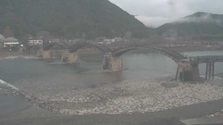
- Kintaikyo Bridge | Kintaikyo Bridge Shimogawara Parking Lot, 1-5 Iwakuni, Iwakuni City, Yamaguchi Prefecture 741-0062 | Kintaikyo Bridge / Iwakuni City Office
- Kanmuriyama Park | Kanmuriyama Park, 6288 Murozumimura, Hikari City, Yamaguchi Prefecture 743-0001 | Hikari City Office
- Shunan City Area | KRY Yamaguchi Broadcasting, Tokuyamakoen Ward, Shunan City, Yamaguchi Prefecture 745-8686
- Saba River (Hofu City / Yamaguchi City ) | Saba River Live Video (Hori, Urushio, Kamimigita, Shimbashi) | Yamaguchi River National Highway Office
- Roads in Yamaguchi | site title: Yamaguchi Road Information | camera titles: Yamaguchi Prefectural Road – R490 Naganobori Bridge, R315 Shunan City, R262 Hagi City, Yamaguchi City
- National Highways in Yamaguchi | camera titles: National Route road surface information provision | address: Ministry of Land, Infrastructure and Transport Yamaguchi River National Highway Office, 1-10-20 Kokuga, Hofu-shi, Yamaguchi 747-0024 | site title: Ministry of Land, Infrastructure and Transport Yamaguchi River National Highway Office
Yamaguchi Prefecture Tourism Information
The prefectural capital of Yamaguchi Prefecture is Yamaguchi City. The population of the prefecture is approximately 1.4 million people. The prefecture was once called “Nagato Country” and “Suo Country,” and it was governed by Mr. Mouri during Warring States period.
It became Yamaguchi Prefecture in 1871 after abolition of feudal domains and establishment of prefectures. In the end stage of the Tokugawa Shogunate, Choshu-han (the old name of Yamaguchi Prefecture) was conquested by the Tokugawa Shogunate, but Chosuhu-han (Choshu Clan) won thanks to the success of Kiheitai that was led by Shinsaku Takasugi et al. Choshu-han played a central role in the Meiji Restoration through the Satchō Alliance that Ryoma Sakamoto mediated. This historical background made Yamaguchi Prefecture the land of strong political tone and political climate, and it already produced nine prime ministers.
Yamaguchi City, which is in central part of the prefecture, has only 190,000 inhabitants despite it is the prefetural capital of Yamaguchi. The population of Shimonoseki City is about 280,000, Ube City about 170,000, Iwakuni City about 140,000, Shunan City about 150,000.
There are tourism resources such as Kintai-kyo Bridge, Yanai no Shirokabe (Yanai’s White Wall), Hofu Tenmangu, Akiyoshi-dai and Akiyoshi-dou, Tokiwa Park, Kanmon Strait, Ganryu-jima (Island).
Kintaikyo Bridge in Iwakuni is a five arched wooden bridge that is specified in the nationally designated scenic spot. In the era of Iwakuni Clan in the 17th century, at the time when bridges had been flowing out often by the flood of Nishikigawa, it was “Kintaikyo-Bridge” that was built by bringing together the crystal essence of the technology of the time to continue to study the bridge that is not shed. It was the bridge that was kept alive for over 200 years after the reconstruction of 1,674, until it was flowed out by the typhoon Kijia in 1950. Reconstruction work was completed in 1953 and then bridged replacement work was performed from 2001 to 2004. “Kintaikyo-Bridge” was built with the advanced technology that is no comparable even when viewed from modern building technology.
Hofu Tenmangu in Hofu City is the shrine dedicated to the god of learning, Michizane Sugawara, and was founded in 904 AD. The shrine is crowded with worshipers of students during exam seasons every year because it is the god of learning.
Akiyoshidai in the city of Miya is Japan’s limestone plateau in Japan (karst plateau) and was the bottom of the sea 300 million years ago. As a special national treasure, it is an attraction of the prefecture’s premiera along with Akiyoshi-do (Akiyoshi Sinus). Akiyoshi-dou (sinus) is Japan’s largest limestone cave and 1km out of total length 8.9km is open as a tourist route. Including Akiyoshi-dou (sinus) 450 caves have been found in Akiyoshi-dai and they are distributed throughout the Akiyoshidai.
Also, there are famous local cuisines of Yamaguchi Prefecture such as Iwakuni Zushi (Sushi of Iwakuni), which is said that it was made by an order of a lord in preparation for battle, and Fuku Ryouri (cuisine of good fortune), a cuisine of blowfish that is called “Fuku (good fortune)” for good luck.