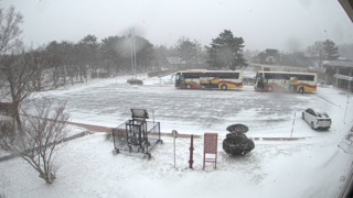
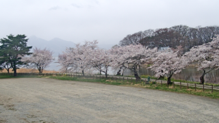
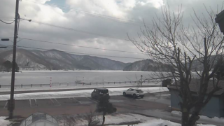
This page compiles links to live camera listing pages for various municipalities within Fukushima Prefecture. Fukushima Prefecture is a vast prefecture located in the southern Tohoku region, divided into three areas—Naka-tōri, Hama-tōri, and Aizu—by the Ōu Mountains and Abukuma Highlands. Using the Live Camera feed, you can check real-time images of diverse scenery throughout the four seasons, including Bandai Mountain, Lake Inawashiro, Azuma Mountain, Miharu Waterfall Cherry Blossoms, and the Abukuma River. View the latest footage from Fukushima Prefecture’s Live Cameras, covering road snow accumulation and icy conditions, river water levels, and tourist spot congestion, organized by municipality.
Live Camera Information for Nakadori (Prefectural North, Prefectural Central, and Prefectural South Areas)
This covers the main street area extending from Fukushima City to Shirakawa City. In addition, there are many live cameras available at tourist destinations such as Azumayama Jodo-daira and Miharu Waterfall Cherry Blossoms, alongside key locations like the prefectural capital, Fukushima City, and Koriyama City, the largest city in the prefecture.
Fukushima City | Koriyama City | Shirakawa City | Sugakawa City | Fujimatsu City | Tamura City | Dateichi City | Hongu City | Kuawari Town | Kunimi Town | Kawamata Town | Otama Village | Kagamiishi-cho | Ten’ei Village | Saigo Village | Izumizaki Village | Nakashima Village | Yabuki Town | Tanakuracho | Yamamatsuri Town | Hanawa Town | Samegawa Village | Ishikawa Town | Tamagawa Village | Hirata Village | Asakawa Town | Kodotomachi | Miharu Town | ONO Town
Hamadori Live Camera
This is the Hamadori area facing the Pacific Ocean. In addition to Iwaki City, Soma City, and Minami-Soma City, many live cameras are installed along the coastline, including Shioyazaki Lighthouse and Kitaizumi Coast.
Iwaki City | Soma City | Minamisoma City | Hirano TownNaraha Town | Tomioka Town | Kawahai Village | OgumamachiFutabacho TownNamiemisuto | Katsuo Village | Shinchi Town | Iidate Village
Aizu area live camera
This is the Aizu area, which gathers tourist destinations representing Fukushima Prefecture, including Bandai Mountain, Inawashiro Lake, Ura-Bandi, Hirahara Lake, and Ouchijuku. It also offers comprehensive live cameras for disaster prevention and weather monitoring, such as road conditions during snowy periods and volcanic surveillance cameras on Mt. Bandai.
Aizu-Wakamatsu City | Kitakata City | Shimago Town | Hiei-Kegimura Village | Tadami-machi | Minami Aizu Town | Kita-Shiobara Village | Nishi-Aizu Town | Bandai Town | Inawashiro Town | Aizu-Sakameshitamachi | Yugawa Village | Yanagitsu Town | Mishima Town | Kanayama Town | Showa Village | Aizu-Misato Town
Live Camera Information of Prefectural Rivers
Rivers in Fukushima Prefecture
Major live cameras throughout the prefecture
- Fukushima Airport (Tamakawa Village) | Fukushima Airport Apron and Parking Lot Live Camera | Fukushima Prefectural Fukushima Airport Office – Fukushima Chuo TV
- Fukushima City (Miyamacho, Fukushima City / Omachi) | Fukushima City Live Camera | Fukushima Television Fukushima Broadcasting
- Inawashiro Lake (Koriyama City, Konan Town) | Funatsu Park Inawashiro Lake Live Camera | Koriyama City Tourist Association
- Kaisei Yama Park (Kooriyama City Kaisei) | Kaisei-san Park Live Camera | Koriyama Tourist Association
- Shiki no Sato Ryokusuien (Kikuda Town, Koriyama City) ② | Seasonal Village Midori Suien Live Camera Information | Koriyama City Tourist Association
- Miharu Waterfall Cherry Blossoms (Miharu Town Falls) | Miharu Waterfall Cherry Blossom Live Camera Information | Miharu Town Hall
- Koshiro Cherry Blossoms (Kodonocho) | Koshido Cherry Blossom Live Camera Information | Kodonomachi Town Office
- Shibazakura (Hirata Village) | Jupiterland Hirata Cherry Blossom Live Camera | Hirata Village Office
- Yunogami Onsen Station (Shimo-goto Town Yunogami) | Yunokami Onsen Station Live Camera | Shimogō Town Hall
- Azumayama Jodohei (Tsuchiyu Onsen Town, Fukushima City) | Azumayama Jodo Plain Live Camera | Fukushima River and National Highway Office
- Adachi Tara Yama Wakamiya (Wakamiya, Inawashiro Town) | Adachi-Tarayama Wakamiya Live Camera | Japan Meteorological Agency (JMA)
- Kunimiyama (Minamisoma City) | Kunimiyama Live Camera | Minamisoma City Hall
- Mikazamayama (Kodonomachi) | Mikazuyama Summit Fujimidai Live Camera | Kotonemachi Town Hall
- Bandaiyama (Inawashiro Town) ② | Inawashiro Town Hall Bandai Mountain Live Camera | Inawashiro Town Hall
- Bandaiyama (Hirae, Kitashiobara Village) | Bandaiyama Kenkō Ridge Live Camera Information | Japan Meteorological Agency (JMA)
- Ura-Bandai Rengeuma Bandai Mountain (Hira-hara Village, Kitashiobara) | Uri Bandai Renge-numa Bandaiyama Live Camera | The National Institute of Informatics
- Hiraibako (Kita-Shiobara Village) | Hiraoka Lake Live Camera | Ura-Bandai Lake Resort
- Shioya Cape Lighthouse (Hirayuakisō, Iwaki City) | Shioya Cape Lighthouse Live Camera | Japan Coast Guard
- Kitaizumi Coast (Minamisoma City) | Kitaizumi Beach Live Camera | Minamisoma City Hall
- Soma Port (Haragama, Soma City) | Sama Port Live Camera | Fukushima Prefecture Soma Harbor Construction Office
- Throughout the prefectureLive Camera Information for four cities within Fukushima Prefecture (Fukushima, Koriyama, Aizu-Wakamatsu, Onahama) / TUFchannel
- Tajimi RiverLocation of Tanami River Basin Water Level Gauge Installations: Zuikoji Bridge, Mishima Ohashi Bridge, Nishiya Bridge, Shibakura Bridge, Minamigawa confluence point / Tanami River Basin Water Level Gauge Data
- Entire area within Fukushima PrefecturePrefecture-wide Road Conditions / Utsukushima Fukushima
- Entire Area of Minami Aizu DistrictMinami Aizu District Road Status / Current Scenes in Minami Aizu
- Fukushima Nuclear Power PlantFukushima Daiichi Live Camera (Unit 1 side/Unit 4 side)/TEPCO
- Abukuma Plateau RoadAbukuma Kogen Road (Yabuki IC, Yabuki Chuo IC, Yabuki Chuo IC, Utsukushima Ohashi, Tamagawa IC, Hiryu Ohashi, Fukushima Airport IC, Ishikawa Mabata IC, Hirata Nishi IC, Hirata IC, Ono IC) / Abukuma Kogen Road Management Office
- Abukuma River/ LIVE Abukumagawa / Ministry of Land, Infrastructure, Transport and Tourism Tohoku Regional Development Bureau Fukushima River and National Highway Office
- Aga RiverLive Aga River (Aga River Basin Live Footage) / Yamashina, Migagawa Drainage Facility Rooftop (Nichihashigawa), Miyukobashi, Shingukawa, Aga River River Office, Magoshi, Minehara, Okawa Dam Management Office Rooftop / Ministry of Land, Infrastructure, Transport and Tourism (MLIT) Hokuriku Regional Development Bureau Aga River River Office
- Various locations throughout the prefectureFukushima City HQ Camera, Koriyama City Camera, Aizu-Wakamatsu City Camera, Iwaki City Camera, JNN Fukushima Daiichi Nuclear Power Plant Information Camera / Television U Fukushima Co., Ltd.
- Prefectural roadsImage Information for Prefectural Roads, etc. National Routes 4, 49, 13, 115, 118, 289, and Expressways / Fukushima Prefectural Road Management Division
- Tohoku Area Expressway“Snowy Road Live Cameras” for Tohoku Expressway, Hachinohe Expressway, Akita Expressway, Yamagata Expressway, Banetsu Expressway, and Yuzawa-Yokote Road / Drapura E-NEXCO Drive Plaza
- Koriyama – Shirakawa – Aizu Road InformationShirakawa/Saigo Area, National Route 4 and Kōshi Road; Koriyama Higashi/Hirata Area, National Route 49; Inawashiro/Atami Area, National Route 49; Bandai Kawato/Kosai Area, National Route 49; Nishi-Aizu/Yagizu/Saka-shita Area, National Route 49; Aizu Main Northern Road, etc. / Ministry of Land, Infrastructure, Transport and Tourism Tohoku Regional Development Bureau Koriyama National Route Office
Fukushima Prefecture Live Camera Map
Fukushima Prefecture weather forecast
- Yahoo! JAPAN Weather/Disaster – Fukushima Prefecture Weather
- Japan Meteorological Agency Disaster Prevention Information – AMeDAS (Temperature/Precipitation/Wind Direction and Speed/Sunshine Hours/Snow Depth)
- Japan Meteorological Agency Disaster Prevention Information – Radar/Nowcast (Precipitation/Lightning/Tornadoes)
Fukushima Prefecture news
About Fukushima Prefecture
Fukushima Prefecture is located in the southern part of the Tohoku region and boasts an area of approximately 13,784km², ranking third nationwide. The population is about 1.82 million people, and the prefectural capital is Fukushima City. Koriyama City and Iwaki City serve as major urban centers, driving the economic and industrial core of the prefecture. Three distinct regions—Naka-Tōri, Hama-Tōri, and Aizu—are spanned by the Ōu Mountains, Abukuma Plateau, and Echigo Mountains, each with significantly different climates and cultures. Bandai-san (1,816m) and Lake Inawashiro are famous tourist spots nationwide, and numerous Live Cameras have been installed in areas like Ura-Bandai and around Azuma Mountain. Water levels of major rivers such as the Abukuma River, Agano River, and Tajimi River can also be checked in real time via Live Cameras. Miharu Takizakura and Hanami-yama Park are famous cherry blossom spots that attract tourists from all over Japan during spring. During winter, heavy snow falls in the Aizu area facing the Sea of Japan, making live cameras showing snowfall and road conditions particularly high-demand information.