Tochigi Prefecture Live Cameras
Tochigi Prefecture Southern (Utsunomiya)
Utsunomiya City | Ashikaga City | Tochigi City | Sano City | Kanuma City | Oyama City | Moka City | Sakura City | Nasukarasuyama City | Shimotsuke City | Kaminokawa Town | Mashiko Town | Motegi Town | Ichikai Town | Haga Town | Mibu Town | Nogi Town | Takanezawa Town | Nakagawa Town
Tochigi Prefecture Northern part (Otawara)
Nikko City | Ohtawara City | Yaita City | Nasushiobara City | Shioya Town | Nasu Town
All over the prefecture
- Watarase River | Real-time video of Watarase River | Watarase River Office, Tanaka-cho, Ashikaga City, Tochigi Prefecture
- Prefectural Rivers | Omoi River, Uzuma river, Tone river, Watarase river | Tone River Upstream River Office
- National Route 4 and Route 50 | National Route 4: Tochifuku Bridge, Tochifuku Bridge South, Kashiwanuma P, Nasu Snow Removal Base, Urushitsuka Karishita, Yumakichu, Nasuno Bridge, Nozaki Bridge, Shintonegawa Bridge, Tagawa Bridge, Shintonegawa Bridge down, Shintonegawa Bridge up, Kokubunji branch office, National Route 50: Ashikaga land bridge, Ohira high bridge up, Koyama Ohashi Tochifuku bridge / Utsunomiya national highway office
- Kinugawa / Kokaigawa | Kinugawa Basin: Ishii branch office, Kawashima water level observatory, Mizukaido water level observatory, Kokaigawa Basin: Mitani water level observatory, Kuroko water level observatory, Kamigo water level observatory | Shimodate River Office
- Prefectural Roads | Road Information Camera (CCTV) | Tochigi Prefectural Land Development Department Road Conservation Division ” Tochigi Road Management Information”
- Prefectural Rivers | “Tochigi prefecture real-time rainfall river water level observation information river live camera” Miyanohashi (Higashibashi) (Tagawa), Senouchibashi (Gogyogawa), Kankobashi (Shikawa), Ohirabashigami (Naganogawa), Ohashi (Akiyama) River), Renjo Bridge (Arakawa), Tochigi Bridge (Kogai River), Kibata Ohashi (Sakagawa), Shinonome Bridge (Kurokawa), Yosasa Bridge (Naka River), Nakayosasa Bridge (Yosasa River), Yodo Bridge (Sugawa) Ohashi (Jaio River), Chitose Bridge (Fukuro River), Kasane Bridge (Yosasa River)
- Kanto Region Expressways | Tohoku Expressway : Shirakawa IC-Nasu IC, Yaita IC-Nishinasuno-Shiobara IC, Kanetsu Expressway: Numata-Mizukami, Maebashi-Shibukawa Ikaho, Joshinetsu Expressway: Susaka Nagano Higashi IC-Shinshu Nakano IC, Usui Karuizawa IC, Tomioka IC | Dorapura E-NEXCO Drive Plaza
- Kokaigawa River and Kinugawa River | address: Shimodate River Office, Niginari, Chikusei City, Tochigi | camera titles: Utsunomiya City, Chikusei City, Joso City, Moka City | site title: Shimodate River Office
- Sugata River and Tagawa River, Shimotsuke City | camera titles: Disaster Prevention Cameras (Rivers) ① Sugata River (Minowa bridge), ② Tagawa River (Tanijiga Bridge) | site title: Shimotsuke City Hall
- Prefecture Roads | camera titles: Road information cameras (CCTV) | site title: Tochigi Prefecture Prefecture Road management information
Tochigi Prefecture Tourism Information
Tochigi Prefecture in the north of Kanto region iand is the inland prefecture that is in contact with Fukushima Prefecture, Gunma Prefecture, Ibaraki Prefecture and Saitama Prefecture. The prefectural population is about 2 million people, and the population of the prefectural capital, Utsunomiya City, is about 50 thousand people. After the domain system was abolished, the current Tochigi Prefecture was born with the merger of Utsunomiya Prefecture and Tochigi Prefecture in 1873. The prefectural name is derived from Tochigi town, the prefectural capital at the time. The area of the prefecture is 6,408 square km, about 84km from east to west, and is 98km from north to south.
In the northwest of the prefectural land, there are mountainous areas, such as Nasu mountain range, Taishaku mountains and Ashio mountains, and in the eastern part of the prefecture there are Yamizo Mountains, and in the central part of the prefecture there are wider plains. In northwest part of the prefecture, Nikko City, there are altitude 2,000m class mountains, such as Shiranesan, Nantaisan, Nyohosan, Taishakuyama and Suzugatake.
Kinunuma Swamp in Nikko City is said to be the highest altitude marshy grassland in Japan and a high moor in the altitude of 2,000m. In addition, wetlands and Watarase basins of Okunikko are registered in the Ramsar Convention for the purpose of protection of wetlands and waterfowls. More than half of the prefectural land is forest area and agricultural land accounts for about 20%. The Tohoku Expressway and the Tohoku Shinkansen run vertically in the prefecture and in the south Kitakanto motorway cross the prefecture.
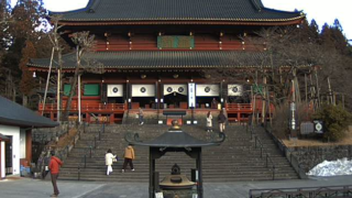
As the tourist destinations of the prefecture Nikko, Kinugawa, Nasu are famous and there are famous hot springs such as Kinugawa Onsen, Nikko Yumoto Onsen, Nasu Onsen, Shiobara Onsen and others. In addition, nine national treasure buildings and 94 important cultural assets buildings of Nikko Futarasan Jinja (Shrine), Nikko Toshogu and Nikkosan Rinnoji Temple, have been registered in the world’s cultural heritage as “shrines and temples of Nikko”. The traditional craft “Yukitsumugi” is designated as an important intangible cultural heritage of the country and UNESCO intangible cultural heritage.
The typical agricultural and livestock products of Tochigi Prefecture are strawberry, chrysanthemum, Koshihikari, beef, pears, milk and so on, and “Tochiotome” is the strawberry that is known as a specialty product representing Tochigi. The regional cuisines are “Shimotsukare”, the stews that Salmon head and chips of soybean and vegetables are stewed with sake lees, “Chitakesoba”, the buckwheat noodles with the soup made of “Chichitake (Lactarius volemus)”, “Utsunomiya gyoza”, the dumpling of the brand product that is a registered trademark of Utsunomiya Dumpling Association.