Ehime Prefecture Live Cameras
Ehime Prefecture Chuyo (Matsuyama)
Matsuyama City | Iyo City | Toon City | Kumakogen Town | Masaki Town | Tobe Town
Ehime Prefecture Toyo (Niihama)
Imabari City | Niihama City | Saijo City | Shikokuchuo City | Kamijima Town
Ehime Prefecture Nanyo (Uwajima)
Uwajima City | Yawatahama City | Ozu City | Seiyo City | Uchiko Town | Ikata Town | Matsuno Town | Kihoku Town | Ainan Town
All over the prefecture
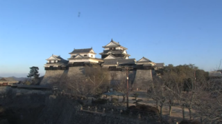
- Matsuyama Castle | Matsuyama Castle, 1 Marunouchi, Matsuyama City, Ehime Prefecture, 790-0008 | Nankai Broadcasting (RNB)
- Ishizuchi Shrine Jojusha Mt. Ishizuchi | Ishizuchi Shrine Chugu Jojusha, 417 Komatsucho Ishizuchi, Saijo, Ehime 799-1112 | Ishizuchi Mountain Range Collaborative Business Council
- Nakayamaike Nature Park | Nakayamaike Nature Park, 1542 Kuroiji, Mima-cho, Uwajima-shi, Ehime 798-1116 | Uwajima City Office
- Uwajima City Area | TV Ehime
- Hijikawa estuary panoramic view Hijikawa storm observation park | Hijikawa Arashi Observatory Park, Nagahama Ko, Ozu City, Ehime Prefecture 799-3401 | Ozu River National Highway Office
- Tomisuyama Park | Tomisuyama Park, Otake, Ozu-shi, Ehime 795-0063 | Ozu City Official Website
- Mt. Shoji | Tatsukawa-cho, Niihama City, Ehime Prefecture 792-0846 | Niihama City Tourism and Products Association
- National highway No. 11 Sakura Sanri | Chihara, Tanbara-cho, Saijo-shi, Ehime 791-0538 | Shikoku Regional Development Bureau
- Tomisato Dam | Tomisato Dam, Tomisatocho Tsuneyama, Shikokuchuo, Ehime 799-0645 | Ikeda General Management Office
- Kurushima Strait | Imabari City, Ehime Prefecture | Shimanami Co., Ltd.
- Mt. Sekizen and Seto Inland Sea | Sekizensan, Iwagi, Kamijima-cho, Ochi-gun, Ehime Prefecture 794-2410 | Kamijima Town Office
- Horie Coast | Horie Marine House, 222 Horie-cho, Matsuyama-shi, Ehime 799-2651 | Come on guys
- Matsuyama Kanko Port | Matsuyama Kanko Port Terminal, 5-2259-1 Takahama-cho, Matsuyama-shi, Ehime 791-8081
- Kurushima Strait Kurushima-Kaikyo Bridge | Imabari, Ehime
- Sadamisaki Peninsula | Yobokori, Ikata, Nishiowa District, Ehime 796-0821 | Kairashi
- Hijikawa River | “Camera image of Hijikawa” | Ozu River National Highway Office
- Rivers in Ehime Prefecture | camera title: Ehime Prefecture rivers and erosion control information system (river monitoring system) Kanyu river (Kami Kanazawa bridge), Seki river (Tenno bridge), Kokuryo river (castle), Kamo river (Nagase), Nakayama river (Tano upper), Sosha river (Katayama), Ishite River (Yuwatari), Senjo River (Yawatahama), Hijikawa, Uwa River (Shinryo), Suga River (Warei)
Ehime Prefecture Tourism Information
The prefectural capital of Ehime Prefecture is Matsuyama City. The population of the prefecture is about 1.4 million people, and one-third of the population lives in the city of Takamatsu.
The production of citrus is thrinving in the prefecture, and mandarin orange, kiwi fruit, chestnut are famous agricultural productus of Ehime. There are famous local cuisines such as Jyakoten, which is a tempura of minced small fish, and Uwajima Taimeshi, which is a bowl of rice with a sashimi of sea bream wearing sauce.
Ehime Prfecture was formerly called Iyo no Kuni (the country of Iyo) and the prefecture was divided into three regions, Toyo (Eastern Iyo), Chuyo (Central Iyo) and Nanyo (Southern Iyo). The name of the prefecture, Ehime, comes from the description of “Iyo no Kuni (the country of Iyo) is called Ehime” in “Kojiki (Record of Ancient Matters).”
There are many attractions such as Matsuyama Castle, Uwajima Castle, Dogo Onsen Main Building, Tobe Zoo, Shikoku Karst, Uwa Sea Marine Park, Imabari Castle, etc.
Ehime Prefecture is famous for castle in particular, and the tower of Matsuyama Castle and the tower of Uwajima Castle are the ones of the twelve towers existing in Japan, and Ehime Prefecture is the only prefecture that has two extant towers.
Matsuyama Castle is the castle that was built in 1603 by Yoshiaki Kato who made a great achievement in the Battle of Sekigahara. The castle fortification was completed in 1627 and it was lost by a lightning strike in 1784, but the current tower was completed in 1854 at the end of 35 years of restoration work.
Uwajima Castle was completed in 1601 by Takatora Todo who was called virtuoso of castle fortification. The existing tower has remained to the present after a renovation by Munetoshi Date in 1671.
Dogo Onsen is the oldest hot spring in Japan that is said to be used from three thousand years ago. It is a historical hot spring that continues to operate until now after the main building of Dogo Onsen was constructed in 1894. It is said to be a hot spring (Onsen) related to Soseki Natsume, and is said that he visited the Onsen many times at the time when he lived in Matsuyama city. It can also be used in a day as a public bath and there are several bathing courses depending on your budget. It was designated as a national important cultural property in 1994 because of the valuable architectural style that lasts until today. Dogo Onsen Main Building is one of the typical tourist destinations of Ehime Prefecture.
Ishizuchisan (Mt. Ishizuchi), whichi is 1,982 m above sea level, is the highest mountain of the northwestern part of the Shikoku Mountains in West Japan. It is located between Saijo City and the town of Kumakogen. It was selected to one of the Onehundred Views of Japan (Nihon Hyakkei), as well as one of the best one hundred mountains in Japan (Nihon Hyaku Meizan), and about 300,000 climbers visit annually. It has been worshiped as a mountain of mountain worship since ancient times, and there is Ishizuchi Jinja Jyoju-sha (a part of Ishizuchi Shrine) at the point of 1450m altitude. You can be carried out by using a ropeway and a lift to worship even if it is for climbing. There is a place for hikers to pass, the Kusariba, but there is a detour and you can climb enough.